Project
SolarFormer
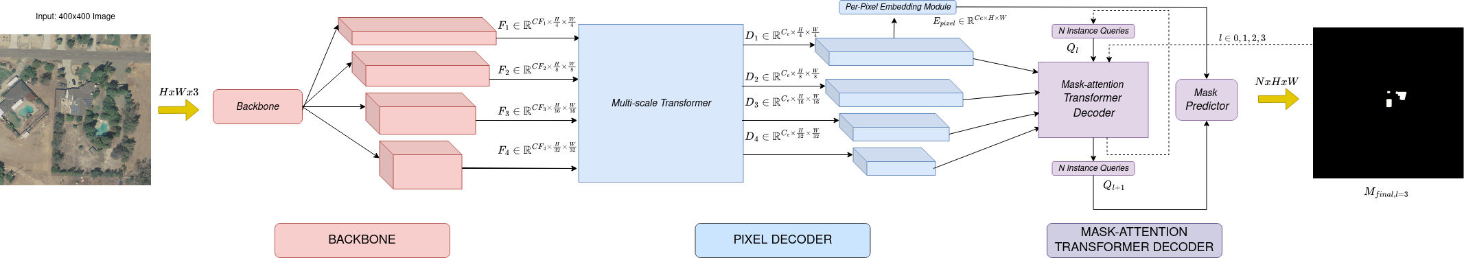
Multi-scale Transformer for Solar PV Profiling
Overview
SolarFormer focuses on mapping and profiling solar photovoltaic installations from aerial imagery. It combines a multi-scale Transformer encoder with a masked-attention Transformer decoder to improve localization of solar panels under varying imagery conditions.
SolarFormer++ extends this line of work to obstruction localization for degradation mitigation using satellite and UAV imagery.
Research Context
Solar panel identification is affected by weather, roof conditions, ground sampling distance, and visual variation across regions. The project evaluates the model on datasets across France and California with different GSD settings.